
|
|
|
National Geographic European Russia Wall Map
By National Geographic
|
|
|
What are rails?
The type of Rails available for this map are wooden dowels that connect to the top and the bottom of the map to help it hang flat against the wall.
The top rail has a thin rope that can hang from a hook or nail.
The bottom rail has a thin rope used to pull the map down.
These rails serve as a hanging option that eliminates the need for tape or pushpins. | 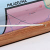
 | | (click on the images for a closer view) |
|
|
|
|
Product Highlights |
|
National Geographic European Russia Wall Map |
|
Item#:
X NGA EUR RUS |
This detailed wall map of European Russia by National Geographic features Western Russia, large portions of Scandinavia, the Baltic region, Turkey ,and portions of the countries surrounding the Caspian and Black seas.
Details featured on this European Russia Wall Map include:
• Political Boundaries
• Major Cities and Capitals
• Physical Terrain Shading
• Mountain Ranges, Highest Point
• Lakes, Rivers and Waterways
• Latitude and Longitude Lines
• Basic Bathymetry (Ocean Depths)
• Major Airports
• National Parks
|
|
 |
More Product Details
From the Print on Demand collection, this map requires 7 business days to print and laminate prior to shipping. Sizes are approximate and may vary due to the nature of the trimming and laminating processes.
This stunning, large-format print from the award-winning National Geographic World Atlas is informative with excellent attention to detail, clarity, color and accuracy, making it perfect for home, office, or school. This collection of wall maps includes Oceans, Continents, Countries, USA Regions and International Regions available in both Political and Physical detail.
|
|
Shipping Conditions
Maps.com ships only to US & Canada
 | This product can only be shipped to the Domestic U.S.A. (No APO's or PO Boxes) |  | This map requires 2 business days to print and laminate prior to shipping. |
|
|
|
Best Seller ranking based
on customer purchases.
|
|